
New DISPERSE Publications
New papers published in Nature Scientific Reports, Quaternary International, Evolutionary Anthropology, Internet Archaeology, Comptes Rendus Geoscience and Archaeology in Oceania.
For summaries see below, and for full publication details and links see the Publications section of the Outputs menu.
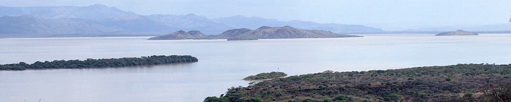
Kübler, S., Owenga, P., Reynolds, S.C., Rucina, S.M., King, G.C.P. 2015. Animal movements in the Kenya Rift and evidence for the earliest ambush hunting by hominins. Nature Scientific Reports 5, 14011: 1–7.
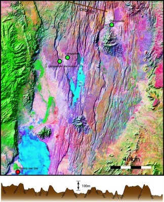
This paper presents some of the first results of applying the 'tectonic landscape model' or 'complex topography hypothesis' to the analysis of sites in the Kenya Rift. Modelling of tectonic motions, faulting and caldera formation and collapse, informed by field observations, shows how the physical topography in geologically active rift settings can be restored to its original configuration. It shows that the long-term attractions of sites such as Olorgesailie can best be explained in terms of locations offering tactical advantage in the exploitation of physical barriers and patchy distributions of edaphically favourable soils to trap large mammals during their seasonal migrations, conditions that persisted over long periods and through multiple changes of climate. One of the unexpected outcomes of the analysis is to demonstrate that the Rift region is relatively impoverished in grazing resources for large mammals and restricts their movements between better and more extensive grazing in the East and the West to predictable and unavoidable corridors across the Rift where they can easily be ambushed. Low numbers of competing predators, abundant sources of raw materials for stone artefacts and a freshwater lake that persisted over long periods because of the tectonic history of the region make Olorgesailie an ideal location for early developments in predictive hunting. Click here for further information and here
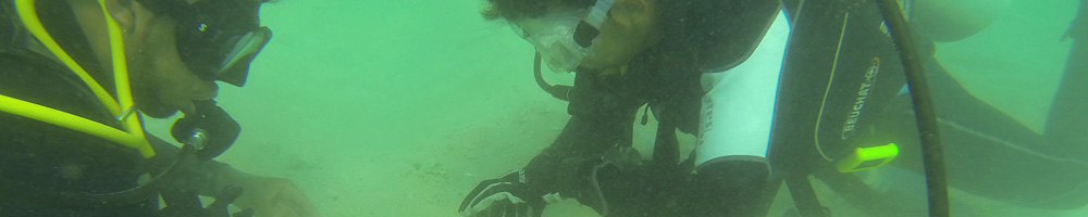
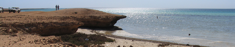
Bailey, G.N., Devès, M.H., Inglis, R.H., Meredith-Williams, M.G., Momber, G., Sakellarious, D., Sinclair, A.G.M., Rousakis, G., Al Ghamdi, S., Alsharekh, A. 2015. Blue Arabia: Palaeolithic and underwater survey in SW Saudi Arabia and the role of coasts in Pleistocene dispersal. Quaternary International 382: 42–57
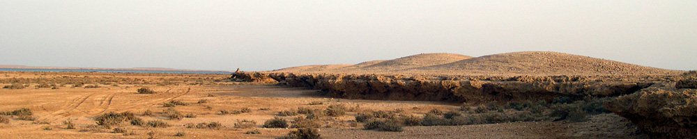
Summarises the recent results of onland and deep-water offshore survey in Southwest Saudi Arabia, sets out the strategy of combined underwater and terrestrial investigation in relation to the overall aims of the DISPERSE Project, and evaluates the results in relation to hypotheses about early seafaring, use of marine resources and coastal landscapes, the effects of sea-level change, and coastal dispersal in the southern Arabian Peninsula. Outcomes of the work so far are the demonstration of a deep history of Pleistocene occupation including stratified sites in the persistently 'green' coastal region region of SW Saudi Arabia, and the existence of an extensive, topographically complex and well-watered landscape on the now submerged shelf that became available when human settlement in the interior was restricted by episodes of more arid climate. The paper concludes that dispersal in the wider region is unlikely to have been exclusively marine- or terrestrial-oriented, but rather variable according to sub-regional variations in coastal conditions and episodic variations in Pleistocene climate and sea-level change, that coastal landscapes especially submerged ones are likely to have been persistently attractive as much for exploitation of terrestrial resources as marine, that sea crossings would have been easily facilitated by narrow sea channels and offshore islands during periods of low sea level without the need for technological developments in seafaring, and that such conditions may have offered a suitable environment for early experiments in sea travel.
Groucutt, H. S., Petraglia, M. D., Bailey, G., Scerri, E. M. L., Parton, A., Clark-Balzan, L., Jennings, R. P., Lewis, L., Blinkhorn, J., Drake, N. A., Breeze, P. S., Inglis, R. H., Devès, M. H., Meredith-Williams, M., Boivin, N., Thomas, M. G. and Scally, A. (2015), Rethinking the dispersal of Homo sapiens out of Africa. Evolutionary Anthropology 24: 149–164.
This is a joint paper by members of three ERC-funded Projects: DISPERSE, PALAEODESERTS and SEALINKS, providing an overview and evaluation of current debates on the timing and pathways of dispersal associated with anatomically modern humans, including issues of similarities and differences in stone technology, palaeogenetics, geochronology, distributions of archaeological sites, and changes in climate and coastal landscapes. The evaluation of evidence is framed in relation to currently opposed 'early' and 'late' chronologies for modern human dispersal, and emphasises the lack of decisive evidence for or against any of the currently available hypotheses, the need for additional investigations particularly in the under-researched SE Asian region, and the need for improved communication and interdisciplinary understanding between the many different scientific disciplines that contribute to current debates about hominin dispersals.
Winder, N.P., Winder, I.C. 2015. Complexity, compassion and self-organisation: human evolution and the vulnerable ape hypothesis. Internet Archaeology 40. http://dx.doi.org/10.11141/ia.40.3.
This is a joint paper between the DISPERSE and COMPLEX projects. The paper examines the history of ideas associated with the development of the ‘modern synthesis’ of evolution with its gene-centred approach, and its current breakdown and progressive replacement by an ‘extended synthesis’, which allows greater scope for the operation of human agency. The authors argue that culture is an integral feature of human (and pre-human) ecology and evolutionary history, and they provide a theoretical framework for incorporating features such as altruism and compassion that have often been treated as distinctively human and incapable of satisfactory explanation within a biologically-based theory of evolution.
Winder, I.C. 2015. Landscape structures and human evolutionary ecology: space, scale and environmental patterning in Africa. Internet Archaeology 38: doi.org/10.11141/ia.38.8.
Focuses on the importance of spatial pattern and landscape in early hominin investigations and analyses the spatial structures of extant African environments at different scales across four regions of potential significance to early human evolution. The analysis demonstrates how mapping at a variety of scales from the local scale to the regional and continental scale can reveal underlying similarities and contrasts, and increase understanding of broad landscape patterns and their relationship to other environmental variables. This mapping exercise highlights the 'local landscape' scale as a key focus for linking diverse sources of information and integrating information on global climatic and other environmental parameters with the evidence from individual locations with fossil and archaeological deposits.
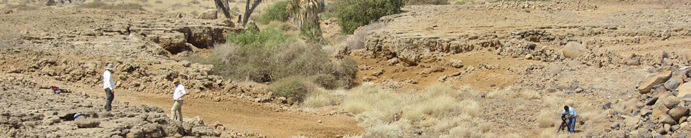
Devès, M.H., Reynolds, S., King, G.C.P., Kübler, S., Sturdy, D., Godet, N. 2015. Insights from earth sciences into human evolution studies: the examples of prehistoric landscape use in Africa and the Levant. Comptes Rendus Geosciences 347: 210–211.
Provides a wide-ranging review of the different ways in which an earth science perspective can provide new insights into the relationship between environmental variables, site distributions and patterns of hominin dispersal, drawing on examples from the Project's fieldwork in East Africa and the southern Levant. Particular emphasis is placed on the ecologically beneficial effects of fault motions and volcanic lava flows in creating attractive landscapes for concentrating food and water resources, and on the variable edaphic properties of soils associated with different geological substrates and the consequent constraints imposed on the distribution and seasonal movements of large mammals important in hominin subsistence.
Holdaway, S.J., King, G.C.P., Douglass, M.J., Fanning, P.C. 2015. Human-environment interactions at regional scales: the complex topography hypothesis applied to surface archaeological records in Australia and North America. Archaeology in Oceania 50 (S1): 58–69.
Addresses the nature of mobility patterns and site distributions in ‘Plains’ regions of minimal topographic complexity, as a test of the complex topography hypothesis, comparing western New South Wales, Australia, and the Great Plains region of North America. Regional measures of topographic roughness show subtle but marked differences between the two regions, which can be related to distinctive patterns in stone tool distributions, site-use histories and the predictability and concentration of food and water sources. The Australian example is the limiting case, showing the lowest levels of topographic complexity. This is coupled with low levels of soil nutrients and highly unpredictable rainfall, both consequences in large part of a 'smooth' land surface, requiring specific social adaptations and generating an archaeological record in which there is very little repeated long-term use of the same locations within the wider regional setting.